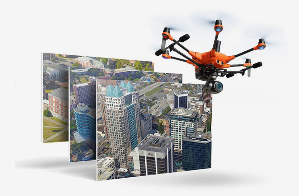
Mapping, measurements, or digital twin modeling delivering actionable data for your business or service anywhere, anytime.
H520E + Skylines’s PhotoMeshTM and TerraExplorerTM 2D/3D Analytics Software
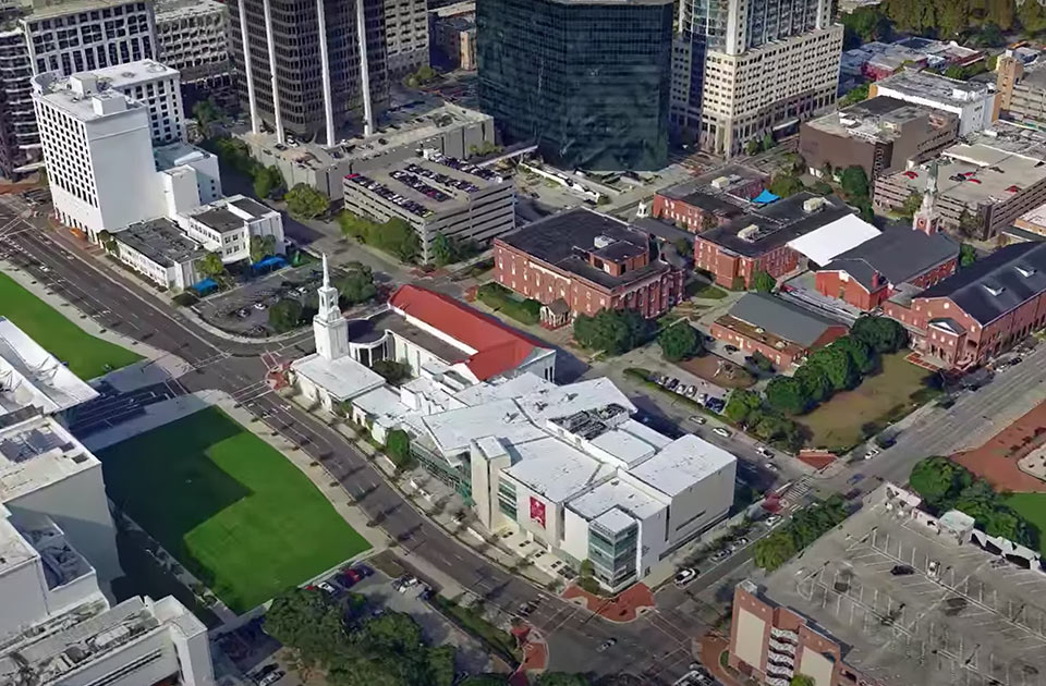
PhotoMeshTM
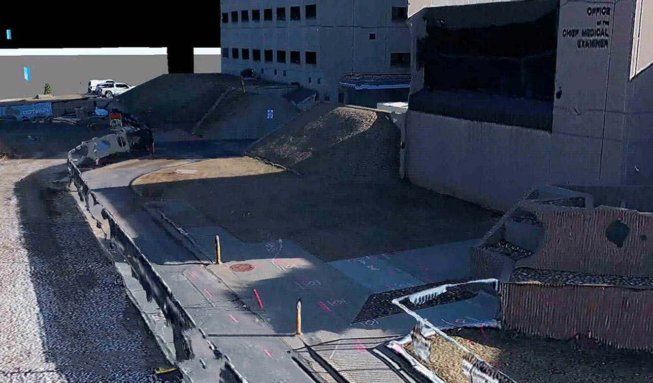
PhotoMeshTM automatically converts the H520E or H520E-RTK oblique and nadir images to high- resolution, textured, 3Dmesh models (3DML), True-Orthophotos (with no building lean)
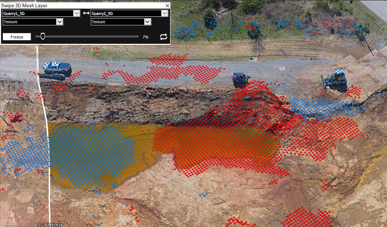
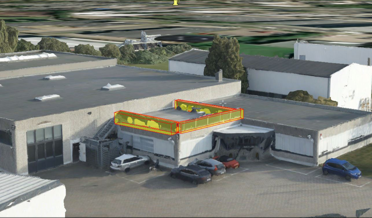
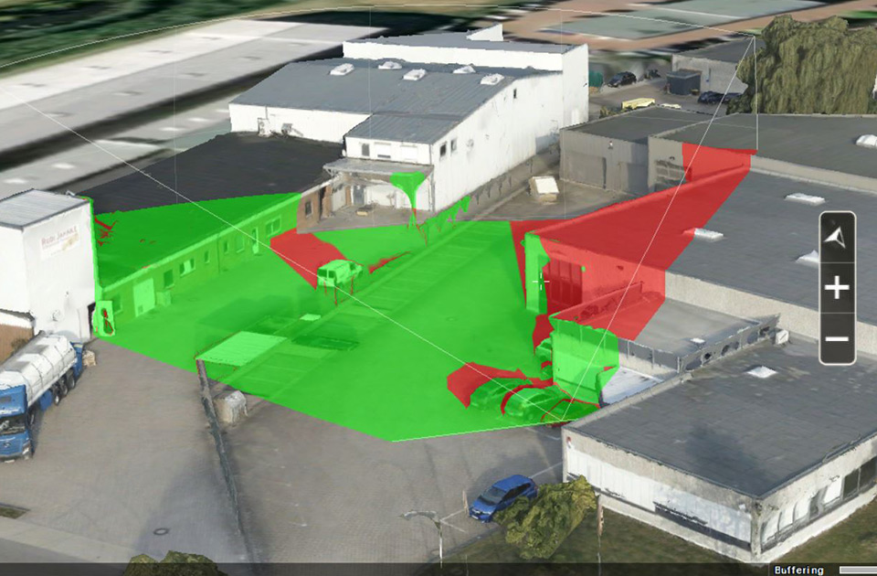
TerraExplorerTM Plus
TerraExplorerTM Plus for editing and analyzing geo-referenced projects from 3D terrain, 3D mesh, Lidar, BIM, raster and feature databases
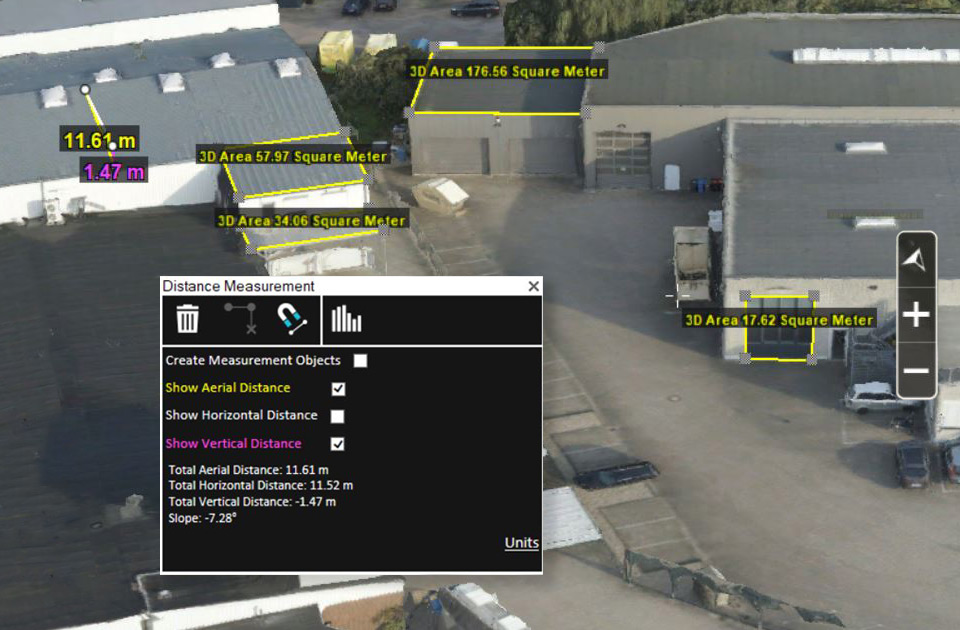
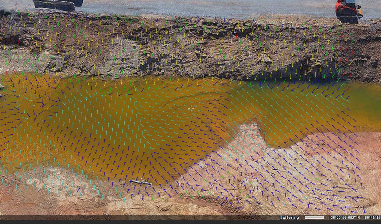
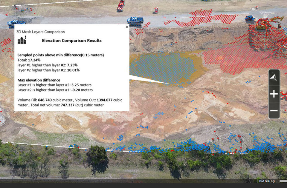
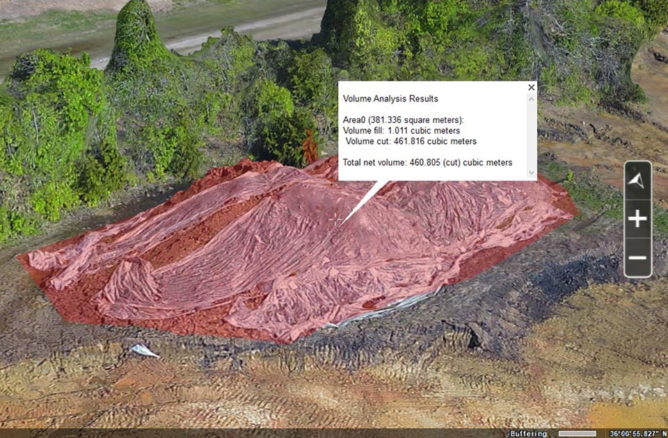
Digital Twin with Measurements
Digital Surface Models, Digital Terrain Models and Photogrammetric Point Clouds
High Quality
Stunning 3DML output with Edge detection/extraction for sharp/crisp images
Superior Precision
Color registration of mesh for more consistently vibrant images
Incorporate LiDAR Data to enhance under vegetation, alleys, and thin features.
Specifically designed for the YUNEEC H520E/RTK E90X camera to produce the highest precision
Maximum Interoperability
Supports Wide Range of Formats
Imports and exports to industry standard file formats to allow model enhancements.
Outputs: 3DML, 3D Tiles, SLPK/I3S, OSGB, OBJ, DAE, Orthophoto, DSM, DTM, and Colorized LAS